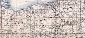
GIS has improved many industries over the years, especially smartphones and GPS applications. By using spatial and temporal information, GIS lets users interact with data as it relates to maps, satellite images, and land topography. Cuyahoga County has compiled property and zoning-related information on a map on the county’s website.
Access From Home
This map offers a much-improved GIS system that allows the public to access property tax and ownership information. Users can get this information from the county’s website simply by using the map to locate title deeds and property taxes for specific places. The map also offers permit information and building sketches for proposed building projects. While these records have always been open to the public, they can be accessed faster and more easily now with this upgraded system. In the past, people would have had to request this information from public records downtown. Now people can access this information much more quickly from home or at a library computer.
How GIS Comes Into Play
The Cuyahoga County map uses spatial/temporal data. The spatial portion refers to the map. But when users click “full map,” they have the option to search records as far back as 1993. Choosing this feature refreshes the map and allows users to search property information from different years. This feature is one small example of the pros of using GIS data to create user applications. Formatting this data into an online map saves people time and effort, and it allows them to quickly jump through the years to search out tax records.
Who Benefits From This System
This information is valuable to future homeowners who can access the property tax information for specific areas, helping them find an area that best suits their price range. The same is true for someone looking to open a small business. Potential business owners can find out what the property tax will be in certain places, helping them find the location that best suits their needs. Business owners can also find permit and zoning information on a building they wish to purchase. Some downtown buildings may have out-of-date permits. Those wishing to purchase that building can find out whether the city inspections are up-to-date, helping buyers locate that safest and most suitable building for sale. Real estate appraisers may also benefit from this system, allowing them to more quickly gather information in order to make accurate appraisals.
Title deed, property tax, and building permits have long been considered public record. Using this new system helps users quickly access this information for whatever purpose necessary. This system is just one small example of how GIS applications can save time and effort for people, making data more accessible and more navigable for the everyday user.


