County Website Updated with GIS Data

Picture Of A Map - Garrett and Associates

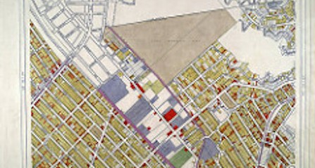
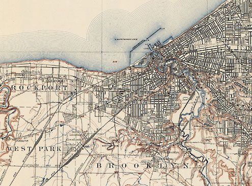
GIS has improved many industries over the years, especially smartphones and GPS applications. By using spatial and temporal information, GIS lets users interact with data as it relates to maps, satellite images, and land topography. Cuyahoga County has compiled property and zoning-related information on a map on the county’s website.

Access From Home

This map offers a much-improved GIS system that allows the public to access property tax and ownership information. Users can get this information from the county’s website simply by using the map to locate title deeds and property taxes for specific places. The map also offers permit information and building sketches for proposed building projects. While these records have always been open to the public, they can be accessed faster and more easily now with this upgraded system. In the past, people would have had to request this information from public records downtown. Now people can access this information much more quickly from home or at a library computer.

How GIS Comes Into Play

The Cuyahoga County map uses spatial/temporal data. The spatial portion refers to the map. But when users click “full map,” they have the option to search records as far back as 1993. Choosing this feature refreshes the map and allows users to search property information from different years. This feature is one small example of the pros of using GIS data to create user applications. Formatting this data into an online map saves people time and effort, and it allows them to quickly jump through the years to search out tax records.

Who Benefits From This System

This information is valuable to future homeowners who can access the property tax information for specific areas, helping them find an area that best suits their price range. The same is true for someone looking to open a small business. Potential business owners can find out what the property tax will be in certain places, helping them find the location that best suits their needs. Business owners can also find permit and zoning information on a building they wish to purchase. Some downtown buildings may have out-of-date permits. Those wishing to purchase that building can find out whether the city inspections are up-to-date, helping buyers locate that safest and most suitable building for sale. Real estate appraisers may also benefit from this system, allowing them to more quickly gather information in order to make accurate appraisals.

Title deed, property tax, and building permits have long been considered public record. Using this new system helps users quickly access this information for whatever purpose necessary. This system is just one small example of how GIS applications can save time and effort for people, making data more accessible and more navigable for the everyday user.

What the FAST Act Means for Highway Funding

Maintaining roadways is an important part of every city, state, and the federal budget. As recently as 2015, the government has been working to increase federal funding for highway improvements. The House and Senate finally agreed in December to extend the federal transportation funding for an additional five years.

Use It, Pay for It Approach

In order to fund any repairs and upgrades to the highways, the government has taken the stance, “If you use it, then you should help pay for it.” Consumers do this, in part, through the purchase of fuel. Thanks to the gas tax, the Highway Trust Fund is able to make the repairs necessary.

Unfortunately, this fund has been hit hard with rising costs to maintain the roads traveled every day. This is because, unlike the supplies needed, the tax has not been raised since 1993. For some reason, government officials have chosen to freeze this source of income at 18.4 cents per gallon. If the tax had risen with inflation, it would be closer to 33 cents per gallon at this time, almost double where it is currently resting.

Bill Passed in Dec 2015 Shifts Burden

The federal government is trying to add money to the Highway Trust Fund. In a last-minute save, the House and Senate agreed to a new federal funding bill on December 1, 2015.

The bill, known as Fixing America’s Surfaces Transportation Act, or FAST, does utilize the 18.4 cents per gallon tax. To make up the difference, the fund pulls the remaining $16 billion drawing from the general fund. This shift puts the burden on all taxpayers, instead of those who use the roadways.

Fixes the Problem, but Not Long-Term

The new funds help ensure that states continue to receive funding for roadway and infrastructure projects. It is only good for the next five years, however. Without more changes to the Highway Trust Fund, the nation’s roadways could face the same shortfalls in a few years.

Modern Science Gets Inside the Heads of Easter Island

Creating topographical maps that represent the lay of the land used to be a painstaking process that took years of travel and further hours of pouring over collected data. The resulting map, while functional, paints a distorted representation of the actual lay of the land. This baseline understanding of a landmass unlocks the history of its changing terrain and inhabitants, but to a fault. On Rapa Nui, or Easter Island, where questions about its many statues remain unanswered, the shortcomings of old techniques fly in the face of today’s archaeologist.

Advanced Mapping

Modern topography goes beyond the simple record of elevation and land features. Today’s language around the subject concerns geospatial data sets. These comprehensive feeds are the result of thorough research collected using updated techniques such as the near-infrared sensors and the orthophoto. Unlike a typical aerial photograph, the orthophoto accurately depicts a photographic map. Where aerial photos cannot account for tilted shots that create image displacements, an orthophoto creates a uniform scale. The difference between the two may be nearly imperceptible to the human eye, but the photographic map’s value to the researcher leads to more complete data.

Unmanned and Unexpected

Unlike more populated parts of the Earth, Rapa Nui lacks a comprehensive geospatial data set. All known data collected by the human eye answers no questions about the history and reasoning behind the island or its iconic statues. A team of researchers from California State University Long Beach, led by professor of anthropology Carl Lipo, decided to approach this problem using commercial technology known as an unmanned aircraft system.

Unlike the popular quadcopter drones owned by private citizens, the UAS resembles a full-sized airplane. Equipped with a camera and controlled by a computer on the ground, the unmanned unit follows specific flight plans that allow for a much bigger picture with unsullied, inclusive data.

Lipo and his team used the UAS over the course of nine days to cover a section of Rapa Nui. Over the course of 26 missions, the team captured 26 different orthophotos and made strides in topographical and hydrological data. They reported immediate results and observed unique insights based on this data. Lipo reported that, based on the information they gathered, Easter Island’s ancient culture positioned its statues to signify nearby water and not for visibility as previously assumed. The UAS performed so well that CSULB decided to continue covering the entire island in future projects.

A Big Year for GPS

The Global Positioning System, better known to its users as GPS, exists as a complex interlocking network of satellites, operators, and users. Last July 17th, GPS turned 20 years old. In a mere two decades, the technology has changed the way we navigate and orient ourselves. It remains the standard for accuracy in positioning and continues to grow. In fact, this year saw several leaps forward for the famous government program.

The 2nd and 19th Space Operations Squadrons

Referred to as 2 and 19 SOPS, “Team Black Jack,” or the 50th Space Wing, these two integral units consist of the men and women who run GPS from Schriever Air Force Base. While there are many SOPS at Schriever, only two are concerned with GPS. You could think of 2 SOPS as ground control, performing commands and carrying out missions, whereas 19 SOPS dedicates its time to launches and sustaining the operative capacity of satellites in orbit.

The 50th Space Wing’s profound impact on our world goes largely unnoticed, but this year, they received due recognition.

Public Recognition and Events

Last year, the 2 and 19 SOPS took part in multiple public events, even hosting GPS week in February. The educational event involved a tour of Schriever for many middle and high school students and the 2nd squadron visiting local schools in an outreach program. Later in the year, the city of Colorado Springs (near where the program is based) honored the 2 and 19 SOPS on the program’s 20th birthday by declaring July 17th “GPS Day.” With more publicly, the 50th Space Wing and GPS garnered attention on an episode of “60 Minutes.”

Continuing Expansion

In just 2015 alone, the 2 and 19 SOPS launched and assumed command of three new satellites. After three months of preparation, Team Black Jack expanded its network from 8 to 11 total operational satellites. This may mean new and unprecedented advances in GPS’s precision and timing capabilities in the years to come.

Who Is Your Land Surveyor and What Do They Do?

Photo Of A Map - Garrett and Associates

One of the world’s oldest professions is also one of the most in-demand jobs for recent graduates. According to the Department of Labor Statistics, employment opportunities for land surveyors are excellent. The reason? With land development growing at twice the speed of the U.S. population, surveyors are sought after. A stunning 95 percent of students find a job within four months of graduation.

What They Do

The primary responsibility of the average land surveyor is to make precise measurements in order to determine property boundaries. The data they provide is needed for engineering, mapmaking, and construction. In addition to determining the exact location of construction projects based on property lines, land surveyors also dictate the proper depth for building foundations. Clients may include private land developers, government agencies, and others.

Tools of the Trade

According to historians, land surveying dates back to the earliest human civilizations. In Ancient Egypt, for example, early practitioners used chains and steel bands to subdivide the fertile lands around the Nile River for farming. Recent technological advances have made the profession far more precise and less physically demanding. Although they still spend a lot of time in the field, modern surveyors don’t have to do as much walking because their tools, such as a theodolite, measure distance with the help of global positioning system (GPS) technology. These measurements can then be used to present data visually as charts, reports, or maps. They can even create computerized maps to give builders and architects a clearer picture of the land they’ll be working on.

Where They Work

Official employment statistics confirm that the overwhelming majority of surveyors work for private surveying or engineering firms. A much smaller portion is employed by state or local governments. As for the industries they work in, more than two-thirds of land surveyors ply their trade in the architectural and/or engineering fields. Nearly ten percent work for local or state governments, while about half that number (five percent) work in heavy or civil engineering construction. A slightly smaller group is employed by the mining, quarrying, and oil and gas extraction industries.

But no matter who they work for, land surveyors must split their time between field and office work. When in the field, surveyors often work in teams or crews, taking measurements on the job site. Though they are rarely required to walk long distances, surveyors must still inspect land features and take measurements from different spots. This often involves climbing up small hills with heavy packs filled with surveying equipment and instruments. As such, the average surveyor must be physically fit.

Education & Training

Modern surveyors must have a strong academic background in science, mathematics, and mapping. Although some colleges offer a bachelor’s degree program to prepare students to become land surveyors, many have degrees in related fields such as forestry or civil engineering. After graduation, all prospective surveyors must work under a licensed surveyor for about two years to qualify for a surveying license of their own. They must also pass the Principles and Practice of Surveying (PS) exam, which is administered by the state.

Although it takes many years of study and hard work, becoming a land surveyor offers excellent employment opportunities.

The Historical Side Of Land Surveying

Historians aren’t quite sure who made the prehistoric monument at Stonehenge, but they know that early surveying equipment was used. In fact, most ancient civilizations relied on simple geometry and surveying tools to establish land borders and boundaries for building, farming, and city planning. The Romans, for example, built the most advanced system of roads the world had ever seen with the help of land surveyors. Here’s a brief look back at how the profession has changed since those early days.

Equipment: Development and Improvement

Before the 18th century, most surveyors used ropes and chains to measure distance. The great leap forward occurred in 1787, when the first precision theodolite was introduced. The instrument simultaneously measures angles on both vertical and horizontal planes. It helped surveyors quickly and accurately measure angles to distant points, which was invaluable for map making.

But as important as the theodolite was, surveyors still had to manually measure distances to ensure precision. It was not until electronic distance measurement (EDM) was developed in the 1950s that they could finally put away their ropes and chains. The device utilizes microwave transmitters and receivers to determine long distances. Building on this advancement, instruments that measured both distance and angles came on the scene in the 1970s. Known as total stations, their speed and accuracy have continued to improve at an impressive pace. Modern stations can even be operated by remote control!

At present, the theodolite and the total station are considered essential pieces of equipment for professional surveyors. Although GPS technology has come a long way in recent years, it does not yet provide the accuracy and precision professionals need to do their job. As such, GPS equipment is rarely used to the exclusion of more trusted surveying tools.

Measurement Conversions

Because most surveying tools use the metric system, U.S. surveyors must convert their measurements from meters to feet (1 meter = 3.28 feet). Even more confusing is a unit of length and area known as a rod. Used primarily in older property deeds, one rod is equal to 16.5 feet. For federal surveyors who complete U.S. public land surveys, an ancient measurement unit called a chain is still in use. Originally consisting of 100 iron links that were nearly eight inches long, a standard chain is 66 feet in length.

Although the tools and technologies have changed, many ancient units of measurement are still in place today. For the average residential surveyor, it is often enough to simply convert metric measurements to imperial (U.S.) ones. But for federal surveyors, a more complex system based on ancient measurements is still in use.

Understanding Different Types Of Land Surveying

man surveying land - Garrett and Associates

Because banks usually require a land survey before they approve a mortgage loan, most homeowners are acquainted with property surveys. Performed by a licensed land surveyor, these surveys confirm the legal boundaries of residential and commercial properties. Because buying and selling properties is an everyday occurrence, this service keeps surveyors busy all year round. With that said, there are many other surveying services they provide.

ALTA Surveys

A more comprehensive property survey, the ALTA survey includes mortgage, boundary, and topographic surveys. More commonly used for commercial properties, these surveys are popular because they guarantee a single, universal standard all companies can agree on.

Mortgage Surveys

Mentioned earlier, mortgage surveys determine the land boundaries of a property. They can also calculate the location of any structure, such as a home, apartment building, or condominium that is located on the land. The main reason lending institutions require these surveys is because they want to make sure any structures on the property meet current building and zoning codes.

Topographic Surveys

Used to pinpoint the location of both natural and man-made features, topographic surveys are sometimes required by the government. They generally include trees, streams, fences, and detached structures. Much like some maps, they use contour lines to indicate relative elevation. Often used by architects and engineers, topographic surveys help them plan certain projects more precisely.

Construction Surveys

Important tools through the entire construction process, surveys help engineers, builders, and architects plan their next steps. All projects begin with a site or plot plan that lays out the plan for the entire project, from start to finish. There are also as-built surveys that confirm that all authorized work was completed according to the specifications set forth in the plot plan. Lastly, a foundation survey is completed as soon as the foundation of the building has been cured. Its purpose is to verify that the foundation was poured in the proper location and according to accepted standards.

Deformation Survey

Generally used on public lands, such as parks, a deformation survey helps determine if an object or structure is changing shape or moving. If, for example, a birdwatching tower were believed to be sinking into the ground, a land surveyor would record the specific points of the tower in order to determine its exact position. He or she would then wait for a certain period of time before retaking the measurement points. If the points were different, the surveyor would report that the tower is indeed sinking.

Hydrographic Survey

It may make their job title a misnomer, but land surveyors also perform bathymetric and hydrographic surveys on bodies of water. To do so, they must measure things like water depth, water levels, bottom contours, and direction of the current (if there is one). For navigational purposes, they must also record the location and position of landmarks and other fixed objects.

Although this is only but a partial list, the aforementioned options are the most common types of land surveys.

Five Historical Figures Who Were Land Surveyors

Photo Of George Washington On Mt. Rushmore - Garrett and Associates

In addition to being brave men and women who accomplished monumental things, several famous names from American history were also land surveyors. Here are five of them.

George Washington

Not only was he a great general and the first U.S. President, but George Washington was also an experienced land surveyor. Starting as a teenager, the strapping lad would go on to survey over two hundred tracts of land in his life. The skill served Washington well, helping him acquire more than 65,000 acres of land in thirty-seven locations. At the time of his death, he was one of the wealthiest landowners in Virginia.

Thomas Jefferson

Another U.S. President from Virginia, Thomas Jefferson was a Renaissance man who explored numerous fields of knowledge—one of which was land surveying. Appointed County Surveyor for Albemarle County, Virginia in 1773, he would use the skills he acquired in that post as Secretary of State (under President Washington). According to historians, Jefferson helped manage teams of federal land surveyors who were responsible for the orderly settlement of the frontier.

Abraham Lincoln

Before he was a small-town lawyer and a U.S. President, Abraham Lincoln was a local land surveyor. Appointed Surveyor for Sangamon County, Illinois in 1833, young Lincoln was responsible for surveying roads, boundary lines, town lots, and settling boundary disputes.

Daniel Boone

Not every famous land surveyor was also a U.S. President. Daniel Boone was a early American explorer, woodsman, and pioneer. His intimate knowledge of the wilderness that is now Kentucky made him the few men qualified to survey the land of that region. As such, he was named Deputy County Surveyor for Lincoln County, Kentucky in 1783.

Lewis & Clark

Shortly after President Thomas Jefferson completed the Louisiana Purchase in 1803, he commissioned an expedition to explore the new lands. Captain Meriwether Lewis and his friend, Second Lieutenant William Clark, were put in command. Both men had studied surveying; Lewis had been taught the subject by President Jefferson, while Clark had learned land surveying and mapping in the army. On the expedition, Lewis was responsible for most of the celestial observations, while Clark drew most of the maps.

A challenging profession, land surveying was instrumental to the creation of every modern nation. Because the United States was once an uncharted wilderness, many of its most famous citizens studied the science at some point. Some of them even accomplished great things with the help of their training.

Photo Credit: James Hawley

How Technology Is Shaping The Future Of Land Surveying

Photo Of A Land Surveyor - Garrett & Associates

Technology has forever changed the ancient art/science of land surveying. Although experts still rely on old-fashioned tools of the trade, such as compasses, levels, and measuring wheels, modern gadgets help them collect information a lot faster. New equipment and techniques have undeniably altered the profession, making it much broader than it was in the past. Many surveyors now see themselves as project information managers, rather than outside consultants who complete a few specialized tasks. Here is a list of the equipment they might use.

Total Station Theodolite – A modern version of an ancient tool, the total station is a theodolite, or transit, that is equipped with an electronic distance meter. Capable of reading slope distances to specific points from hundreds of yards away, the tool can save surveyors hours on mapping, stakeout, and property line surveying.

3-D Laser Scanner – With the help of this invaluable instrument, surveyors can now create digital 3-D models that help architects accurately visualize the land they will be building on.

Satellite Positioning Systems – Once considered a luxury, GPS technology is now an essential surveying tool experts use to collect data in the field on a daily basis.

GIS Software – The same software that runs programs like Google Maps is utilized by surveyors to create digital maps of nearly any area. Helpful in establishing property lines, these maps are widely used in construction projects of all sizes.

Deep Tows – Contrary to popular belief, surveyors don’t only work on dry land. Some of them explore the ocean floor with equipment called deep tows. These underwater survey systems use sonar or cameras that are towed by vessels to capture images of the ocean floor, which may later be used for academic or construction purposes.

Drones – Many forward-thinking surveyors believe that drones are the biggest thing to happen to the profession since the compass. Inexpensive and easy to operate, these unmanned aircraft are the ideal platform for remote sensing and aerial photography. With the information drones can collect, surveyors can simply and affordably provide accurate measurements, maps, and models of any size project.

New technologies have given surveyors the ability to take a more active role in the construction cycle, from beginning to end. Because the information they collect, analyze, and interpret is needed at all steps and stages of the process, surveyors are fast becoming active members of the management team.

Land Surveying History: More Than Meets the Eye.

Garrett & Associates

Wherever monuments were built in the ancient world, wherever man raised his eyes to the heavens and built on earth, a surveyor was there. Whether the circles of Stonehenge, the pyramids of Egypt or South America, the ancient temples of Greece and Rome, all were laid out with specific relationships that codified the relationship between the people, their government, and their deity.

The earliest recorded surveys were conducted by the ancient Egyptians. Famous for their monuments, they are perhaps best known now for the only remaining structure of the original “Seven wonders of the world,” the Great Pyramid of Giza. For 3,800 years the tallest structure in the world, it’s almost exact north-south orientation and precise geometry are a testament to the surveyors who laid out the plan using little more than knotted ropes and plumb bobs. But the Egyptians used surveying for more than establishing their monuments, there are 4,000 year old clay tablets establishing property boundaries for ownership and sale of land. These provided the basis for the Egyptian economy, for agriculture, and for trade throughout the region. As the Nile river flooded each year, washing away boundary markers, surveying was an annual necessity for the continuance of a civil society.

As Greek civilization grew they looked to Egypt, as the Romans in turn looked to Greece. Around 522 B.C.E. it was the engineer Eupalinos who dug the underground aqueduct that bears his name on the island of Samos. Over a thousand meters in length, the tunnel was dug through solid rock from both ends simultaneously, tunneling through a mountain to provide an uninterruptible water source for the town. Without exact measurements the two tunnels may have never met, but Eupalinos managed the feat with tremendous accuracy, using nothing more than Geometry and a perhaps a forerunner to the surveying instrument invented by the Greeks, the Dioptra. A disc leveled by screws and inscribed with angles, the dioptra could be used to determine the angle between two distant objects from a fixed point.

The Romans adapted the Dioptra, and well as a Mesopotamian tool they called the Groma. Together with spirit levels and odometers, these tools provided surveyors and engineers with all the information necessary to lay out colonies, build cities and monuments, aqueducts and roads, some of which are still in use today. At it’s height, the Roman water system used eleven separate aqueducts spanning almost 400 kilometers to bring over one million cubic meters of clean water into the city every day.

It wasn’t until the 16th century that the Theodolite came into use. A precision instrument for measuring angles in both the horizontal and vertical planes, it has survived into the modern era with continual upgrades. In the United States, George Washington, Daniel Boone and Lewis and Clark are but a few of the surveyors whose use of the theodolite had profound impacts on the young nation’s history. In civil engineering circles, Mt. Rushmore is often jokingly referred to as “three surveyors and some other guy,” though there is a move afoot to consider Theodore Roosevelt a surveyor as well. His famous 1913-1914 map-making expedition to Brazil resulted in a river there being named after him (Rio Roosevelt, sometimes known as Rio Teodoro) and almost cost him his life.

Modern theodolites now come equipped with infra-red based measuring devices, software, and may even be remote controlled. Though the technology has changed, the goal remains the same as it has been throughout land surveying history: to quantify the unknown.