New Technology Makes Surveying More Accurate

Throughout history, the surveying field has used the latest technology to create accurate readings of the land and structures on it. New technological advancements are now allowing surveyors to create three-dimensional models in shorter times with greater accuracy.

Computers Help Make It Easier

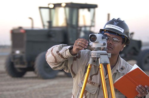
Today’s advancements are no different. With the latest technology, surveyors are able to digitally map the location and calculate distances that are hundreds of meters away. The new total station can be easily operated by a single surveyor. By using a remote control at the operating station, robotic drones can be sent to map an area.

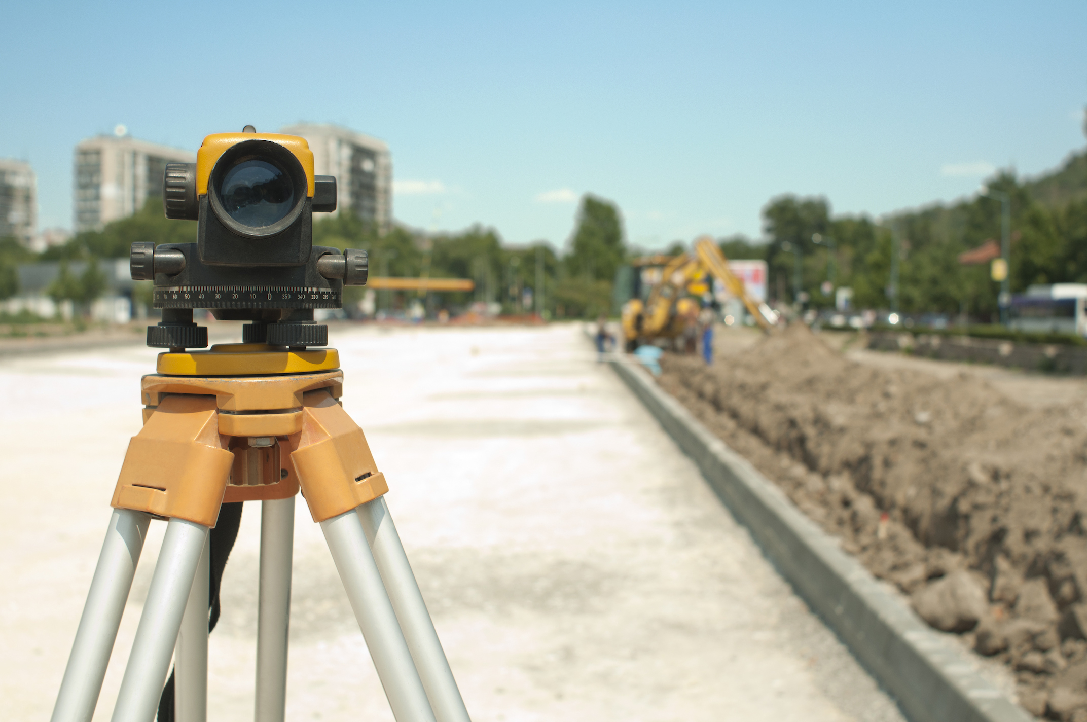
In conjunction or in place of the robotics, a 3D laser scanner allows surveyors to understand the shape and angles of the surface of the land and any buildings on it. The data collected by the instruments are then used to create a three-dimensional model for architects.

Global Positioning Software allows the team to use satellite technology to pinpoint data on land. Since the satellites do not require a line of site between the two points, surveying of larger land areas happens in a shorter amount of time. It also reduces the number of surveying teams needed to complete a large job.

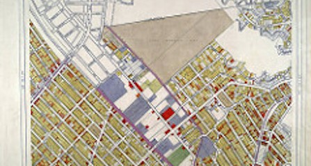
Along with the GPS technology, new GIS software captures this data. The computer processes this information to create a digital map of the area. Map designers produce larger area maps quickly and accurately. Online services such as MapQuest and Google Maps are some examples of groups using this technology.

Technology Helps Save Shorelines

Autonomous underwater vehicles are an essential piece of technology utilized by surveyors. These systems are outfitted with cameras and sonar to read the shoreline in a given area. In the event of an oil spill, this technology can help shoreline cleanup and assessment teams determine how spills will affect the environment.

Breathing New Life into the Surveyor Career

Surveyors determine the three-dimensional positions on the Earth and the distances and angles between them. This information is used to create maps of an area. It is also used to establish boundaries for owners and to situate new buildings on properties. It is a profession for those with brains and creativity.

Education

In order to begin work in the surveying field, it is important to have a college degree. While there might not be a specific “land surveyor” major at most traditional universities, those who wish to enter this field must have a firm understanding of mathematics. The areas of geometry and trigonometry are essential to calculating the angles and distances between objects. Additionally, surveyors need to have experience with engineering and physics if they want to specialize in construction.

Many technical colleges offer both associate and bachelor’s degrees in mapping, geomatics, and even surveying. These majors are certain to help students reach their surveying career goals and help get them on the road to state licensure in this field.

The computer boom has made the use of computer software an integral part of the job. Computing power allows for better statistical analysis and the creation of metadata in order to have more accurate positional information. In order to continue to develop these programs, new surveyors should seek an understanding of programming code.

Paths of the Surveyor

Surveying is a diverse career with many unique paths to choose from. For example, those who want to create aerial maps and enjoy photography may consider the path of a photogrammetrist. In this specialty, the surveyor takes aerial photos of terrain in order to create detailed three-dimensional maps, which include topography, existing structures, and vegetation. The maps are used to help track oil spill movements in order to determine any coastal community impact.

Another interesting specialty in this field is that of forensics. Forensic surveyors analyze, collect data, and map areas for use as evidence in impending court cases. Some examples would be boundary disputes, vehicular wrecks, and industrial accidents. Those choosing this path must be able to communicate effectively. They need to understand the technical aspect of surveying while being able to explain it in a non-technical way to laymen.

There are also other paths surveyors can choose, including:

– Hydrography

– Geodesy

– Topography

– Construction

GIS Analyst

Surveying is anything but a boring career. It provides an outlet for a wide range of skills including physics, mathematics, photography, cartography, and forensics. It’s perfect for professionals who want to get out of the office and break the 9 to 5 routine.

County Website Updated with GIS Data

Picture Of A Map - Garrett and Associates

GIS has improved many industries over the years, especially smartphones and GPS applications. By using spatial and temporal information, GIS lets users interact with data as it relates to maps, satellite images, and land topography. Cuyahoga County has compiled property and zoning-related information on a map on the county’s website.

Access From Home

This map offers a much-improved GIS system that allows the public to access property tax and ownership information. Users can get this information from the county’s website simply by using the map to locate title deeds and property taxes for specific places. The map also offers permit information and building sketches for proposed building projects. While these records have always been open to the public, they can be accessed faster and more easily now with this upgraded system. In the past, people would have had to request this information from public records downtown. Now people can access this information much more quickly from home or at a library computer.

How GIS Comes Into Play

The Cuyahoga County map uses spatial/temporal data. The spatial portion refers to the map. But when users click “full map,” they have the option to search records as far back as 1993. Choosing this feature refreshes the map and allows users to search property information from different years. This feature is one small example of the pros of using GIS data to create user applications. Formatting this data into an online map saves people time and effort, and it allows them to quickly jump through the years to search out tax records.

Who Benefits From This System

This information is valuable to future homeowners who can access the property tax information for specific areas, helping them find an area that best suits their price range. The same is true for someone looking to open a small business. Potential business owners can find out what the property tax will be in certain places, helping them find the location that best suits their needs. Business owners can also find permit and zoning information on a building they wish to purchase. Some downtown buildings may have out-of-date permits. Those wishing to purchase that building can find out whether the city inspections are up-to-date, helping buyers locate that safest and most suitable building for sale. Real estate appraisers may also benefit from this system, allowing them to more quickly gather information in order to make accurate appraisals.

Title deed, property tax, and building permits have long been considered public record. Using this new system helps users quickly access this information for whatever purpose necessary. This system is just one small example of how GIS applications can save time and effort for people, making data more accessible and more navigable for the everyday user.

Modern Science Gets Inside the Heads of Easter Island

Creating topographical maps that represent the lay of the land used to be a painstaking process that took years of travel and further hours of pouring over collected data. The resulting map, while functional, paints a distorted representation of the actual lay of the land. This baseline understanding of a landmass unlocks the history of its changing terrain and inhabitants, but to a fault. On Rapa Nui, or Easter Island, where questions about its many statues remain unanswered, the shortcomings of old techniques fly in the face of today’s archaeologist.

Advanced Mapping

Modern topography goes beyond the simple record of elevation and land features. Today’s language around the subject concerns geospatial data sets. These comprehensive feeds are the result of thorough research collected using updated techniques such as the near-infrared sensors and the orthophoto. Unlike a typical aerial photograph, the orthophoto accurately depicts a photographic map. Where aerial photos cannot account for tilted shots that create image displacements, an orthophoto creates a uniform scale. The difference between the two may be nearly imperceptible to the human eye, but the photographic map’s value to the researcher leads to more complete data.

Unmanned and Unexpected

Unlike more populated parts of the Earth, Rapa Nui lacks a comprehensive geospatial data set. All known data collected by the human eye answers no questions about the history and reasoning behind the island or its iconic statues. A team of researchers from California State University Long Beach, led by professor of anthropology Carl Lipo, decided to approach this problem using commercial technology known as an unmanned aircraft system.

Unlike the popular quadcopter drones owned by private citizens, the UAS resembles a full-sized airplane. Equipped with a camera and controlled by a computer on the ground, the unmanned unit follows specific flight plans that allow for a much bigger picture with unsullied, inclusive data.

Lipo and his team used the UAS over the course of nine days to cover a section of Rapa Nui. Over the course of 26 missions, the team captured 26 different orthophotos and made strides in topographical and hydrological data. They reported immediate results and observed unique insights based on this data. Lipo reported that, based on the information they gathered, Easter Island’s ancient culture positioned its statues to signify nearby water and not for visibility as previously assumed. The UAS performed so well that CSULB decided to continue covering the entire island in future projects.

An Airborne Aquifer Survey

Aquifers are underground regions of porous rock from which water can be siphoned. Wells are vital for the development of rural areas and helpful to communities far removed from lakes and rivers, but knowing exactly where to dig has always been a problem. New technology is likely to be a game changer for large-scale surveys.

Water Research in History

Searching for usable water typically means employing one of two techniques. The first, a fairly straight forward method, involves drilling test wells in locations that share characteristics with other known aquifers. With no certainty, however, several wells may be drilled before finding one that produces. Both the labor and expense of drilling are a lot to gamble on wells that may not ultimately produce.

The other known method employs copper spikes and wiring to create a subsurface current against which water would react. Researchers no longer need to drill deep into the earth only to find nothing. Nor do they need to worry about finding unusable water. The spike method detects an aquifer and potential impurities at the same time. While an improvement on drilling, this tedious process still takes time to set up, break down, and transport. This leaves much to be desired for researchers.

A Revolutionary Technique

A research team in Sioux Falls, South Dakota recently developed a new system known as RESOLVE that takes to the air for searching out and testing an aquifer. Using a system of coils and wires that works on principles similar to those of the copper spike technique, a subsurface current generates overhead via a sensor flown by a helicopter. Now, great distances are covered in minutes, producing results as the research team goes. This means less time spent in the field with fewer workers who no longer have to set up multiple locations. RESOLVE provides a faster, cheaper, and easier method of aquifer research.

The data yielded by RESOLVE serves as the blueprint for a simulated aquifer model known as MODFLOW, a new data representation used by the USGS. A multi-formed model system such as this allows for more thorough answers to specific questions. MODFLOW provides results such as water purity, most permeable zones for drilling, and unique details about the geology that need to be considered when moving forward.

Working in tandem, RESOLVE and MODFLOW clear the way for other cities to take much of the guesswork out of finding an aquifer.

The ALTA Survey Standards Will Take Effect February 2016

surveyor mapping mountains

The standards that land surveyors adhere to have been updated seven times since they were first introduced in 1962. The most recent update took place in 2011. For over a year, the American Land Title Association (ALTA) has been working with the National Society of Professional Surveyors (NSPS). Together, representatives from each organization have been laboring over a revamped set of standards.

There are currently 14 pages of suggested revisions to the 2011 standards, and a working draft is currently in the process of revision. Since the American Congress of Surveying and Mapping (ACSM) was absorbed by the NSPS, the updated standard’s title may be changed to reflect the changes in the organization. The new title may be revised to “The Minimum Standard Detail Requirements for ALTA/NSPS Land Title Surveys.” Other changes to the standard are much more substantial.

Some of the most relevant changes include:

Clarifications and guidance in the areas of the surveyor’s responsibility in regards to research, as well as guidance for locating and depicting streets and roads. Utility features will need to be shown in new surveys; this will no longer be optional. Updated descriptions will be annotated with the reason for the update, and how the described land relates to the previous record.

Several items will be clarified in the new standards, including Table A items that were negotiated differently from their description in the 2011 Standards. One major concern with Table A item 19 regarding wetlands will be addressed with clarifications to prevent any misunderstanding of the standards that have frequently happened in the past.

Certain surveyor liability issues will be addressed by the removal of Table A item 20b. The updates and clarifications to the standards will, it is hoped, better reflect the current needs of surveyors, landowners, and other interested parties, and improve the quality of information gathered and recorded in these surveys.

New AIA Contract Documents for Design-Build

surveyor on a mountain

New contract documents will make collaborating with industry stakeholders much easier. The American Institute of Architects has come out with six new forms for use on design-build projects.

C103-2015, C201-2015, C202-2015 Forms

The new C103-2015 form can be used as a standard agreement between consultants and owners. It is best used for jobs without a predefined scope of consultant services. However, it is used to establish the expectations between the two parties. It should contain basic terms in regards to licenses, claims, disputes, copyrights, and termination of services.

In addition to using C103-2015, companies should include the new C202-2015, which is a standard Geotechnical Engineering Services form. This additional paperwork will establish any duties and responsibilities of any geotechnical engineer that has been hired as a consultant.

C201-2015 will also be included with C103-2015 in the event of a land survey. The form details the duties of any surveyor that is acting as a consultant. It should include details such as the type of survey being completed: boundary, ALTA/ACSM, or topographic surveys.

While both C201-2015 and C202-2015 may not be necessary for each project, they are not intended to be used as standalone agreements. They are designed to be used with C103-2015.

Six Other Forms

AIA has released an additional six documents for design-build usage. The popular paperwork packet now includes the change order for a design-build project, G741-2015, and the application and certificate for payment, contractor G742C-2015. Other forms are the certificate for payment application, subcontractor agreement, continuation sheet for a design-build project for both contractor and subcontractor, and change directive, numbered G742S-2015, G743C-2015, G743S-2015, and G745-2015 respectively.

Owners, consultants, and contractors can begin using these forms immediately. They are available through the latest AIA Contract desktop software. Users can also go to the AIA documents on demand or on demand plus to obtain each form individually.

Thanks to Hugo Chilsom on flickr for the image used in this post.

Overview of Antique Surveying Processes

Photo Of A Land Surveyor - Garrett & Associates

Land surveying dates back to ancient eras. In fact, the Egyptians likely utilized surveying as they planned and constructed the great pyramids. People have long understood the importance of accurate land surveying because it sets boundaries, which determine who owns which plots of land. In years past, the process was often inaccurate due to rudimentary equipment. Sometimes the surveyor used tools that were of poor quality or in disrepair.

Ancient tools often included the use of sticks, rope, chains, and even body parts such as fingers, feet, and hands. Issues with accuracy were common for surveyors using these tools. As time progressed, equipment advanced to the use of tape measures, slide rulers, logarithmic tables, and calculators.

Land surveying has developed exponentially due to inventions such as the computer and the microchip. With these new technological advances, the process has become both faster and more accurate. Surveyors of today have a wealth of equipment at their disposal. Some of the latest equipment includes:

– Satellite positioning systems that are capable of measuring points or features virtually anywhere on earth from space. An increase in data points utilized has led to clearer images.

– Geographic information system software, which can capture data and analyze it to create highly detailed digital maps.

– Terrestrial mobile LIDAR scanning has the capability of gathering data taken at high speeds to streamline the process.

– Robotic total stations can calculate slope distances down to the nearest centimeter at the touch of a button.

– 3D laser scanners have the ability to interpret shapes of land to aid in visualization and analysis.

Modern land surveying demands monitoring current technology on a continual basis to stay abreast of new developments and equipment. As newer technology allows professionals to plan projects more precisely, they can ensure the best possible land use, which benefits both clients and the environment.

Who Is Your Land Surveyor and What Do They Do?

Photo Of A Map - Garrett and Associates

One of the world’s oldest professions is also one of the most in-demand jobs for recent graduates. According to the Department of Labor Statistics, employment opportunities for land surveyors are excellent. The reason? With land development growing at twice the speed of the U.S. population, surveyors are sought after. A stunning 95 percent of students find a job within four months of graduation.

What They Do

The primary responsibility of the average land surveyor is to make precise measurements in order to determine property boundaries. The data they provide is needed for engineering, mapmaking, and construction. In addition to determining the exact location of construction projects based on property lines, land surveyors also dictate the proper depth for building foundations. Clients may include private land developers, government agencies, and others.

Tools of the Trade

According to historians, land surveying dates back to the earliest human civilizations. In Ancient Egypt, for example, early practitioners used chains and steel bands to subdivide the fertile lands around the Nile River for farming. Recent technological advances have made the profession far more precise and less physically demanding. Although they still spend a lot of time in the field, modern surveyors don’t have to do as much walking because their tools, such as a theodolite, measure distance with the help of global positioning system (GPS) technology. These measurements can then be used to present data visually as charts, reports, or maps. They can even create computerized maps to give builders and architects a clearer picture of the land they’ll be working on.

Where They Work

Official employment statistics confirm that the overwhelming majority of surveyors work for private surveying or engineering firms. A much smaller portion is employed by state or local governments. As for the industries they work in, more than two-thirds of land surveyors ply their trade in the architectural and/or engineering fields. Nearly ten percent work for local or state governments, while about half that number (five percent) work in heavy or civil engineering construction. A slightly smaller group is employed by the mining, quarrying, and oil and gas extraction industries.

But no matter who they work for, land surveyors must split their time between field and office work. When in the field, surveyors often work in teams or crews, taking measurements on the job site. Though they are rarely required to walk long distances, surveyors must still inspect land features and take measurements from different spots. This often involves climbing up small hills with heavy packs filled with surveying equipment and instruments. As such, the average surveyor must be physically fit.

Education & Training

Modern surveyors must have a strong academic background in science, mathematics, and mapping. Although some colleges offer a bachelor’s degree program to prepare students to become land surveyors, many have degrees in related fields such as forestry or civil engineering. After graduation, all prospective surveyors must work under a licensed surveyor for about two years to qualify for a surveying license of their own. They must also pass the Principles and Practice of Surveying (PS) exam, which is administered by the state.

Although it takes many years of study and hard work, becoming a land surveyor offers excellent employment opportunities.

The Historical Side Of Land Surveying

Historians aren’t quite sure who made the prehistoric monument at Stonehenge, but they know that early surveying equipment was used. In fact, most ancient civilizations relied on simple geometry and surveying tools to establish land borders and boundaries for building, farming, and city planning. The Romans, for example, built the most advanced system of roads the world had ever seen with the help of land surveyors. Here’s a brief look back at how the profession has changed since those early days.

Equipment: Development and Improvement

Before the 18th century, most surveyors used ropes and chains to measure distance. The great leap forward occurred in 1787, when the first precision theodolite was introduced. The instrument simultaneously measures angles on both vertical and horizontal planes. It helped surveyors quickly and accurately measure angles to distant points, which was invaluable for map making.

But as important as the theodolite was, surveyors still had to manually measure distances to ensure precision. It was not until electronic distance measurement (EDM) was developed in the 1950s that they could finally put away their ropes and chains. The device utilizes microwave transmitters and receivers to determine long distances. Building on this advancement, instruments that measured both distance and angles came on the scene in the 1970s. Known as total stations, their speed and accuracy have continued to improve at an impressive pace. Modern stations can even be operated by remote control!

At present, the theodolite and the total station are considered essential pieces of equipment for professional surveyors. Although GPS technology has come a long way in recent years, it does not yet provide the accuracy and precision professionals need to do their job. As such, GPS equipment is rarely used to the exclusion of more trusted surveying tools.

Measurement Conversions

Because most surveying tools use the metric system, U.S. surveyors must convert their measurements from meters to feet (1 meter = 3.28 feet). Even more confusing is a unit of length and area known as a rod. Used primarily in older property deeds, one rod is equal to 16.5 feet. For federal surveyors who complete U.S. public land surveys, an ancient measurement unit called a chain is still in use. Originally consisting of 100 iron links that were nearly eight inches long, a standard chain is 66 feet in length.

Although the tools and technologies have changed, many ancient units of measurement are still in place today. For the average residential surveyor, it is often enough to simply convert metric measurements to imperial (U.S.) ones. But for federal surveyors, a more complex system based on ancient measurements is still in use.