Top Five Sediment Control Methods

Sediment control is an important part of maintaining a site. If not implemented, these areas easily become eroded. Wash off from some areas can pollute nearby streams, lakes, and rivers. The following methods offer the best protection and control.

Inlet Protection

One popular type of control is an inlet protection. Drop inlets are secured either around, above, or below the sewage grate. These appliances are often made of non-woven geotextiles. Some are made of synthetic fiberboard or wood chunks. For the drops used below sewer grates, an overflow opening is built-in to the design.

Curb inlet protection apparatuses are often tubing covered in a geofiber fabric. Sometimes the PVC is wrapped in polypropylene material. These products are placed in front of curbside inlets, keeping out sediment, pollutants, and debris from entering storm drains. This protection device does have an overflow gap and filter built in to keep the street from becoming flooded during use.

Perimeter Control

If the construction site is larger than just small repairs along the road, a perimeter device is necessary. Perimeter controls are put in place as a temporary measure, just until permanent ground covers can be put in place. There are several different types of apparatuses used for this task.

Sediment control fences provide a barrier that slows the runoff. It also helps to keep all sediment inside the work site and limits the filtering of sediment out of the site.

In addition to fences, sidewalk barriers help to transport the sediment off-site. This is a temporary trap for runoff. These may be used in conjunction with storm drain inlet devices.

Sediment Traps

In addition to placing barriers around inlets and construction sites, sediment traps are often employed. Scientists usually use these traps to study the quantity of particulates in lakes, rivers, streams, and oceans. However, they can be used in any water system to trap some sediment and keep the runoff from getting into the ecosystem.

Concrete Washout

Making and washing concrete is a major contributor to contamination. A washout helps to contain the runoff. A berm works with mixers, trucks, and wheelbarrows. It allows the concrete to be poured directly in and used. The berm then allows the contaminated water to evaporate safely.

For those who need something that will filter liquid and recycle aggregate for several washouts, a concrete filter is a better option. While it won’t work as well with wheelbarrows, it is compatible with trucks and mixers. The filter pulls sediment from water and reduces the pH. This allows the water to discharge into vegetation when finished.

Check Dam

Check dams are a final way to control sediment at a worksite. This is a temporary structure placed over a drainage ditch, waterway, or swale. This structure interrupts water flow. It also flattens the channel gradient, slowing the flow of water. These structures have been known to collect sediment, however, they should not be the first choice for sediment control since they are not intended for this purpose.

Gaining Perspective on Zika

On February 1, the World Health Organization declared a state of emergency due to new evidence that linked Zika Virus to microcephaly in newborn babies in Brazil. Microcephaly leads children to be born with unnaturally small heads and underdeveloped brains, and plays a significant role in the emergence of neurological disorders including seizures, hearing and vision loss, and poor motor control skills. Naturally, many expectant parents watched with concern as doctors and doomsayers began to speak out about this mysterious virus.

Humble Beginnings

The Zika virus was first identified as a transmittable agent in 1947 by researchers working in the Zika Forest. However it took five years for researchers experimenting on Rhesus monkeys and mice at the East African Virus Research Institute in Entebbe, Uganda to isolate the Zika pathogen. These researchers discovered that much like Dengue and Yellow Fever, Zika is transmitted through the Aedes Aegypti mosquito, which commonly inhabits Africa, Southeast Asia, the Americas, and the Pacific Islands. Although neurons of infected mice showed damage, it was uncertain that Zika could induce any symptoms in humans until renegade researcher William Bearcroft injected himself with the virus strain in 1956 and experienced a mild fever.

Despite its relatively long history, the medical community previously showed little concern over Zika because cases were isolated and symptoms mild. Although common symptoms include chills, skin rash, and conjunctivitis—reddening of the eyes—many people may be exposed to Zika without experiencing any symptoms at all. There are no known treatments or vaccines. Until recently, there was no demand for one.

The Tide Changes

In 2007 opinions towards Zika began to change. That was the year doctors treated the first major outbreak on Yap Island in Micronesia. Forty-nine current cases were diagnosed and 73 percent of residents older than three years old showed evidence of previous infection. Next, French Polynesia experienced a serious outbreak. As of today, 52 countries have reported cases of Zika, most recently Brazil. All of this would be typically viewed without much concern, were it not for the increased incidents of occurrence in tourists combined with potential links discovered between Zika and congenital disorders in unborn infants in Brazil.

Despite the panic, there’s still not a lot of consensus among the medical community about potential risks of Zika, means of transmission, and the scope of the risk. Dr. Peter Hotez of the Sabin Vaccine Institute warns of impending disaster. However, according to doctors from the Centers for Disease Control and Prevention, there is no cause for fear in the United States. Basic precautions like bug spray, protective clothing, and mosquito nets are the most effective way to avoid infection in high-risks areas. For expectant mothers, the CDC and WHO recommends avoiding travel to countries like Brazil where Zika is active.

Due to the amount of time and work that goes into making credible scientific discoveries, it is likely that the history of Zika will continue to unfold for years to come. As medical research continues, by staying aware of new findings, it is possible to weigh the risks and make informed decisions.

Modern Science Gets Inside the Heads of Easter Island

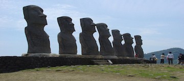
Creating topographical maps that represent the lay of the land used to be a painstaking process that took years of travel and further hours of pouring over collected data. The resulting map, while functional, paints a distorted representation of the actual lay of the land. This baseline understanding of a landmass unlocks the history of its changing terrain and inhabitants, but to a fault. On Rapa Nui, or Easter Island, where questions about its many statues remain unanswered, the shortcomings of old techniques fly in the face of today’s archaeologist.

Advanced Mapping

Modern topography goes beyond the simple record of elevation and land features. Today’s language around the subject concerns geospatial data sets. These comprehensive feeds are the result of thorough research collected using updated techniques such as the near-infrared sensors and the orthophoto. Unlike a typical aerial photograph, the orthophoto accurately depicts a photographic map. Where aerial photos cannot account for tilted shots that create image displacements, an orthophoto creates a uniform scale. The difference between the two may be nearly imperceptible to the human eye, but the photographic map’s value to the researcher leads to more complete data.

Unmanned and Unexpected

Unlike more populated parts of the Earth, Rapa Nui lacks a comprehensive geospatial data set. All known data collected by the human eye answers no questions about the history and reasoning behind the island or its iconic statues. A team of researchers from California State University Long Beach, led by professor of anthropology Carl Lipo, decided to approach this problem using commercial technology known as an unmanned aircraft system.

Unlike the popular quadcopter drones owned by private citizens, the UAS resembles a full-sized airplane. Equipped with a camera and controlled by a computer on the ground, the unmanned unit follows specific flight plans that allow for a much bigger picture with unsullied, inclusive data.

Lipo and his team used the UAS over the course of nine days to cover a section of Rapa Nui. Over the course of 26 missions, the team captured 26 different orthophotos and made strides in topographical and hydrological data. They reported immediate results and observed unique insights based on this data. Lipo reported that, based on the information they gathered, Easter Island’s ancient culture positioned its statues to signify nearby water and not for visibility as previously assumed. The UAS performed so well that CSULB decided to continue covering the entire island in future projects.

A Big Year for GPS

The Global Positioning System, better known to its users as GPS, exists as a complex interlocking network of satellites, operators, and users. Last July 17th, GPS turned 20 years old. In a mere two decades, the technology has changed the way we navigate and orient ourselves. It remains the standard for accuracy in positioning and continues to grow. In fact, this year saw several leaps forward for the famous government program.

The 2nd and 19th Space Operations Squadrons

Referred to as 2 and 19 SOPS, “Team Black Jack,” or the 50th Space Wing, these two integral units consist of the men and women who run GPS from Schriever Air Force Base. While there are many SOPS at Schriever, only two are concerned with GPS. You could think of 2 SOPS as ground control, performing commands and carrying out missions, whereas 19 SOPS dedicates its time to launches and sustaining the operative capacity of satellites in orbit.

The 50th Space Wing’s profound impact on our world goes largely unnoticed, but this year, they received due recognition.

Public Recognition and Events

Last year, the 2 and 19 SOPS took part in multiple public events, even hosting GPS week in February. The educational event involved a tour of Schriever for many middle and high school students and the 2nd squadron visiting local schools in an outreach program. Later in the year, the city of Colorado Springs (near where the program is based) honored the 2 and 19 SOPS on the program’s 20th birthday by declaring July 17th “GPS Day.” With more publicly, the 50th Space Wing and GPS garnered attention on an episode of “60 Minutes.”

Continuing Expansion

In just 2015 alone, the 2 and 19 SOPS launched and assumed command of three new satellites. After three months of preparation, Team Black Jack expanded its network from 8 to 11 total operational satellites. This may mean new and unprecedented advances in GPS’s precision and timing capabilities in the years to come.

The Historical Side Of Land Surveying

Historians aren’t quite sure who made the prehistoric monument at Stonehenge, but they know that early surveying equipment was used. In fact, most ancient civilizations relied on simple geometry and surveying tools to establish land borders and boundaries for building, farming, and city planning. The Romans, for example, built the most advanced system of roads the world had ever seen with the help of land surveyors. Here’s a brief look back at how the profession has changed since those early days.

Equipment: Development and Improvement

Before the 18th century, most surveyors used ropes and chains to measure distance. The great leap forward occurred in 1787, when the first precision theodolite was introduced. The instrument simultaneously measures angles on both vertical and horizontal planes. It helped surveyors quickly and accurately measure angles to distant points, which was invaluable for map making.

But as important as the theodolite was, surveyors still had to manually measure distances to ensure precision. It was not until electronic distance measurement (EDM) was developed in the 1950s that they could finally put away their ropes and chains. The device utilizes microwave transmitters and receivers to determine long distances. Building on this advancement, instruments that measured both distance and angles came on the scene in the 1970s. Known as total stations, their speed and accuracy have continued to improve at an impressive pace. Modern stations can even be operated by remote control!

At present, the theodolite and the total station are considered essential pieces of equipment for professional surveyors. Although GPS technology has come a long way in recent years, it does not yet provide the accuracy and precision professionals need to do their job. As such, GPS equipment is rarely used to the exclusion of more trusted surveying tools.

Measurement Conversions

Because most surveying tools use the metric system, U.S. surveyors must convert their measurements from meters to feet (1 meter = 3.28 feet). Even more confusing is a unit of length and area known as a rod. Used primarily in older property deeds, one rod is equal to 16.5 feet. For federal surveyors who complete U.S. public land surveys, an ancient measurement unit called a chain is still in use. Originally consisting of 100 iron links that were nearly eight inches long, a standard chain is 66 feet in length.

Although the tools and technologies have changed, many ancient units of measurement are still in place today. For the average residential surveyor, it is often enough to simply convert metric measurements to imperial (U.S.) ones. But for federal surveyors, a more complex system based on ancient measurements is still in use.